Wreningham and Ashwellthorpe
Walk Information
Starting Point: Wreningham Village Hall car park, Mill Lane, Wreningham, NR16 1AN.
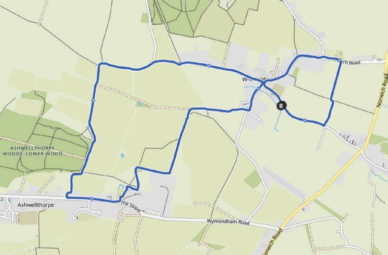
Grid Reference: OS Map 237 TM159984
Walk Length: 3.9 Miles / 6.2 Km
Directions
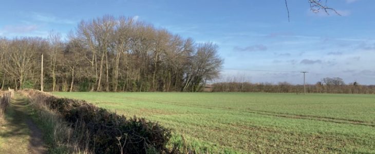
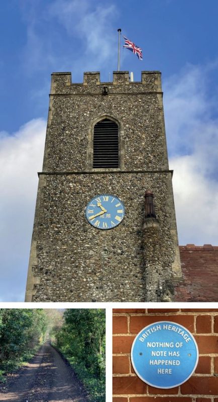
01. Leave the car park and turn right to walk along Mill Road. Pass two entrances on the left, then turn left at a finger post and follow the footpath along the side of the field with the hedge on your left. Turn left at the break in the hedge and immediately right before a hedge. Follow this path to the road with the church opposite. Turn left and walk along Church Road, using the footpath where available.
02. At the crossroads, keep going straight on, passing Wymondham Road on your right and Mill Lane on your left. Turn right opposite Folgate and take the footpath through The Old Stables, Wreningham. Follow this track past farm buildings, bearing left, then right, ignoring a path to the left. Then turn left at the marker post (the track ahead is private) and take the field edge path, keeping the hedge on your left.
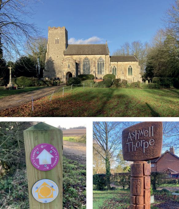
03. Follow the path around the field edge, ignoring paths going off to the left. The field edge path turns right, then left, then right again. Turn left through the gap in the fence (marker post), then keep right to cross a plank bridge and follow the path through Ashwellthorpe Churchyard to the road (The Street).
04. Turn right and walk approx 450 metres along the pavement, passing housing, a farm and some new build houses. Turn right at a marker post and follow the field edge footpath to Lower Wood. Just before reaching the wood, turn right over a plank bridge and after approx 70 metres turn left to cross a wooden bridge. Follow the path beside the edge of the wood.
05. At the end of the wood, continue ahead on the path which then bears left towards a wooden bridge. Cross the bridge and immediately turn right, following a path with a hedge on your right. At the end, go right and immediately left and walk straight across the field (it is well trodden). Go through a gate, down a slight slope and over a plank bridge. Follow the path around to the right, which becomes Old Rectory Lane. Continue along the lane until you reach Wymondham Road. Go right and walk along the road and over the old railway bridge. At the junction, go straight on, back along Mill Road, to return to the Village Hall car park.
Disclaimer: Although this route was checked prior to publication, readers should check for local changes before they walk and ensure they walk within their capabilities.
REVIEWED BY MARK JOHNSON
VOLUNTEER CO-ORDINATOR AT CENTRAL NORFOLK WELLBEING WALKS
Route by Ruth Burn and Sarah Lidington
Route checked by Mark Johnson
Photography by Mark Johnson