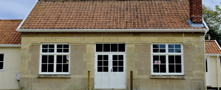
Burston Strike School
Walk Information
Starting Point: Church Green next to Strike School, Diss Road, Burston, Diss IP22 5TP.
Grid Reference: OS Map 230 136831
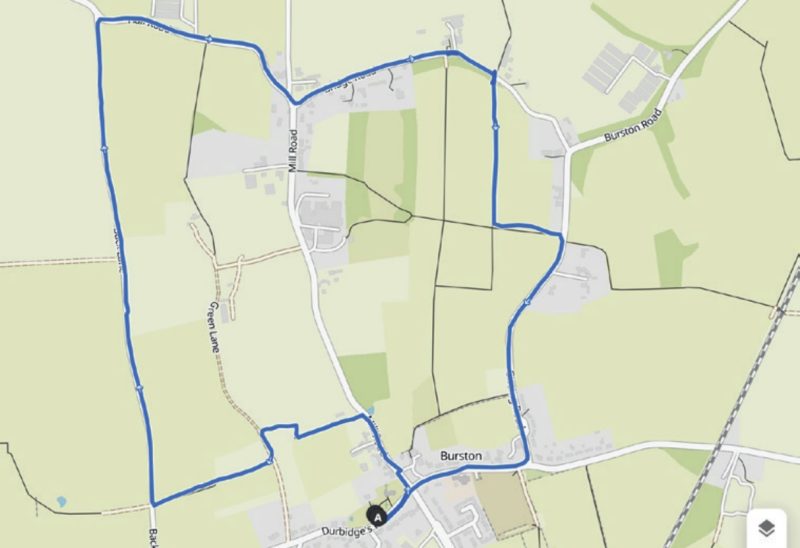
Walk Length: 3 Miles / 4.8 Km
Directions
01. From the school museum, turn left onto Diss Road and then first left onto Mill Road (beware of Lorries here). Turn left through a gate onto a public footpath opposite the 30mph sign. Walk down the hill on the wide grassy path between the orchard and vineyard and go through the gate at the bottom.
02. Turn right, then left at the waymark at the next corner of the field, ignoring any paths leading off to the right into another orchard. Turn left into a track (Green Lane). After a short distance, turn right into a field, keep the hedge on your right, and when this finishes continue in the same direction up to the fingerpost on the road (the line of the public footpath through this field is slightly to the left after the hedge finishes).
03. Turn right at the road and walk along Back Lane to the end. Turn right at the T-junction onto Hall Road; this busier road is signposted to Burston and Dickleburgh. At the next junction, pass Long Lane on the left and then turn immediately left into Mill Green. Further along, this becomes Bridge Road.
04. At a metal barn, turn right off the road, cross a plank bridge and follow the path keeping the hedge on the left. On reaching a gap in the hedge, turn left and aim for the end of the hedge on the far side of the field. On reaching Gissing Road, turn right and follow the road to the end. Turn right at the T-junction and return to the start.
Disclaimer: Although this route was checked prior to publication, readers should check for local changes before they walk and ensure they walk within their capabilities.
REVIEWED BY MARK JOHNSON
VOLUNTEER CO-ORDINATOR AT CENTRAL NORFOLK WELLBEING WALKS
Route by Peter Neave
Route checked by Mark Johnson and Dougie Dingwall
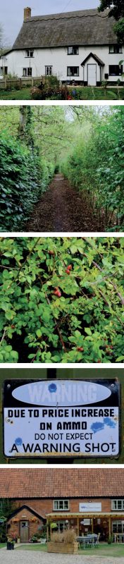
Photography by Dougie Dingwall